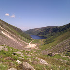
Camaderry, Glendalough, Co. Wicklow (reverse)
 Date: 20 June 2010
Description: Described as a moderate walk in the Lonely Planet guide, I found this tougher at the start than I had expected (about the same intensity as the steep section of Lough Bray). After some messing around at the start (we failed to locate the gravel path Gary had mentioned and end up scrambling up the river bed), we finally hit the ridge and took the shortest path up (straight up!). We found a forest road that brought us up to 350-400m approx and then followed a grass path up to 500m approx (nice stroll). The final climb to the first peak (677m) was strenuous but not too bad. Following the saddle over to the 698m peak was straighforward. Heading over to the reservoir was also fine. The guidebook indicated that finding the path through the heather was a game of luck and our findings agree (even from the top of Camaderry we saw no visible paths down towards the streams). Instead, we headed over to the reservoir perimeter road and then followed the stream back down to the bridge and onto the miner's village. At the miner's village, the local park service had set up a "Falcon Watch" session where visitors could use binoculars or telescopes to look at Peregrine falcon chicks and their parents. They only do this once a year so do check our their website. After chatting with the staff for a few minutes, we made our way park to the car park through the trees (trying to raise a signal (unsuccesfully) on our mobiles so we could contact our driver!).
View Walking route: Camaderry, Glendalough, Co. Wicklow (reverse) in a larger map
Comments